REVIEW 4 major objections 4 minor 67 references
CURL-SLAM: Continuous and Compact LiDAR Mapping
T0 review · 4 major / 4 minor · reviewed 2026-08-06 · deepseek-v4-flash
Pith's one-line read The paper claims that turning LiDAR scans into spherical-harmonic height patches makes the map itself the engine of SLAM, producing globally consistent 3D maps about 0.26 percent of raw point-cloud size and running in real time on a CPU.
desk verdict Solid CURL extension with strong mapping results, but the height-field bias in multi-surface voxels and an overstated trajectory claim need to be addressed before acceptance. read the letter →
The pith
A machine-rendered reading of the paper's core claim, the machinery that carries it, and where it could break.
The reading
What carries the argument
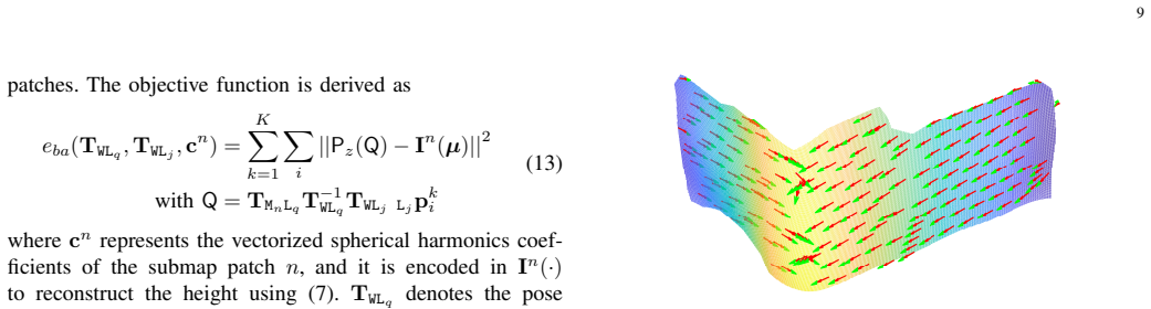
The load-bearing object is the CURL map patch. Each fixed-size cubic voxel is projected onto a reference plane chosen from the patch's point-cloud normal, forming a masked height-augmented image; this image is encoded as a spherical-harmonics expansion $f(\theta,\phi)=\sum_{l=0}^{L}\sum_{m=-l}^{l}c_{l,m}Y_{l,m}(\theta,\phi)$, with a designed coordinate map from image coordinates to spherical angles to keep the encoding bijective. The patch stores the resulting $(L+1)^2$ coefficients, the keyframe pose it is tied to, a binary mask, and an axis-aligned bounding box, and patches are organized in a spatial hashing grid for fast lookup. This object carries the entire argument: it defines the residual in odometry and bundle adjustment, its coefficients are the map state updated by $c^*=c+(Y^T Y)^{-1}Y^T r$, and its basis functions supply the analytic Jacobians that make CPU-rate optimization possible.
What would settle it
Take a LiDAR sequence that deliberately passes an overhang or an alcove whose front and back surfaces fall inside the same 1.5 m voxel, run CURL-SLAM with the default parameters, and compare the reconstructed surface in that voxel against a survey-grade ground-truth mesh; if the central claim is wrong, the two surfaces will collapse into one and the completeness and Chamfer metrics on that region will degrade sharply, while the pose residuals in Eqs. (6) and (13) show a systematic bias.
Extended reading notes
Core claim
CURL-SLAM claims to be the first full LiDAR SLAM system built on the CURL representation, and its central claim is that the same implicit map can serve as the stored geometry, the measurement model for odometry, and the optimization variable in bundle adjustment. Instead of ICP or hand-crafted planar/edge features, each associated patch gives a residual $P_z(Q)-I^k(\mu)$ between the projected height of a scan point and the height reconstructed from the patch's spherical-harmonics coefficients; pose optimization minimizes the sum of these residuals, and local bundle adjustment extends the same residual to jointly update keyframe poses and coefficients, with analytic Jacobians derived for the spherical-harmonics basis. Loop closure is handled by a submap graph plus place recognition, and after pose-graph optimization the overlapping submap patches are merged and their coefficients refined. The experimental section reports that this produces map accuracy better than or comparable to point-cloud, mesh, and neural-implicit baselines on two public benchmark datasets while using, on average, about 2.8 percent of a dense point-cloud map, 13.4 percent of a mesh map, and 51.6 percent of a neural-implicit map, with the whole pipeline running at 10 Hz on a CPU.
Load-bearing premise
The load-bearing assumption is that each voxel-sized patch of the world can be written as a single height above one reference plane; surfaces that are multi-valued in that projection—overhangs, dense vegetation, two opposing walls in the same voxel—are flattened, and the height residuals that drive both odometry and mapping become biased.
Editorial extensions
If this is right
- Because one stored coefficient set can be evaluated at any reconstruction width $\omega$, a robot can keep a single ultra-compact map and query it at coarse resolution for navigation or fine resolution for inspection; the paper reports that accuracy stays roughly constant across $\omega=10$ to $\omega=50$.
- Loop closure in CURL-SLAM corrects the map, not just the trajectory: overlapping current and historical submaps are merged and their spherical-harmonics coefficients jointly refined, which is what removes ghosting artifacts in revisited regions.
- The system runs in real time on a CPU (6.7 Hz in the full configuration and 14.3 Hz in a lighter configuration on a 128-channel sensor), meaning dense, globally consistent mapping no longer requires GPU hardware.
- Map size scales with patch count and harmonic degree, so storage cost follows the paper's formula $N\times((L+1)^2\times 8 + 12\times 4 + 1 + \omega^2/8)$ bytes, making large-scale maps saveable and reloadable as a small binary file.
- The per-patch degree can be chosen by content—degree 2 for ground, degree 5 for non-ground—so the representation adapts its capacity to local geometric complexity without changing the SLAM pipeline.
Reading between the lines
- Inference: Because the residual is structurally the same as photometric error in direct visual odometry, the CURL map could be fused with camera intensity residuals in one joint optimization, letting a single implicit representation serve both LiDAR and vision.
- Inference: The degree ablation showing diminishing returns past degree 5 suggests an adaptive-degree policy—raising the harmonic order only for patches whose residuals demand it—could reduce map size further; the paper fixes degrees and does not test this.
- Inference: A multi-layer extension in which each voxel stores several height fields, one per dominant surface orientation, would extend CURL to overhangs and dense vegetation, the classes of geometry most likely to violate the single-height-per-pixel assumption.
- Inference: Since the map can be queried at arbitrary density from coefficients alone, the same representation could double as a planning cost map, letting a robot plan paths directly on the implicit surface without first extracting a point cloud or mesh.
Editorial analysis
A structured set of objections, weighed in public.
Referee Report
Summary. The paper proposes CURL-SLAM, a LiDAR SLAM system built on the Continuous and Ultra-compact Representation of LiDAR (CURL). The map is organized as voxel patches encoded by spherical-harmonics coefficients, and pose estimation is formulated as a frame-to-submap optimization over height residuals, extended by a local bundle adjustment and loop closure with pose-graph optimization. Experiments on Newer College and FusionPortable report map reconstruction quality competitive with or better than HBA, SLAMesh, and PIN-SLAM, with substantially smaller map sizes and CPU-only real-time operation. The paper also derives analytical Jacobians for the pose and bundle-adjustment residuals and validates them against numerical gradients.
Significance. If the claims hold, the paper makes a useful practical contribution: a CPU-only LiDAR SLAM system with a compact, continuously reconstructable implicit map and a complete loop-closure pipeline. The derivation of analytic Jacobians for the spherical-harmonics residuals is a genuine technical element, and the reported validation against numerical gradients is a strength. The compactness results (about 0.26% of raw point-cloud size in the illustrative example) are striking. However, the central pose and mapping residuals rely on a single-valued height-field assumption per voxel patch, and the experimental comparison lacks repeated-run uncertainty. Both issues need to be addressed before the general SLAM claim is fully supported.
major comments (4)
- [Sections III-D, III-E and Eqs. (6), (13)] The pose and BA residuals assume that each voxel patch can be represented as a single-valued height image under a chosen reference plane, and that the spherical-harmonics fit of that height image is a valid model of the surface. In a voxel that contains two surfaces along the projection normal (opposing vertical wall faces, floor and ceiling, overhangs, or the interior of a corner), the covariance-based plane selection in Eq. (1) cannot make both surfaces single-valued under any axis-aligned projection. The least-squares fit then stores a blended height, the residual in Eq. (6) is nonzero at the true pose, and the optimizer is attracted to a biased pose. This is an internal property of the objective, not a difference of external opinion. Please add a controlled experiment, synthetic or real, with voxels containing two surfaces and quantify pose and map error as a function of surface separation; if the limitation is inherent, it should be stated explicitly in the abstract and in the claims of generality.
- [Section VI-A3 and Table I footnote] The text states that "All mapping parameters are kept consistent across all experiments," but the footnote to Table I reports that the stairs sequence used s=0.5 m instead of the default s=1.5 m, and Table VII marks sequences on which "all the available associated patches" were used for pose estimation rather than the default β_ng=β_g=30. These are parameter changes, not mere implementation details. Please either report results for the stairs and asterisked sequences under the default settings, or qualify the statement of parameter consistency. Without this, the comparison across sequences and against baselines is difficult to assess.
- [Tables I, II, VI, VII] All metric values appear to be from single runs, with no error bars, no repeated trials, and no statistical significance tests. Map accuracy metrics also depend on the ICP alignment of the reconstructed map to the ground-truth map and on the mesh-sampling procedure, neither of which is described in enough detail to assess variance. Given that the paper claims state-of-the-art mapping quality, please report multiple runs or per-sequence variance, and specify the exact alignment and uniform-sampling protocol used for the quantitative map evaluations.
- [Section IV-B and Table VIII] The local BA experiments compare pose-graph-only and with-BA settings on the same runs, and Table VIII shows that improvements are often at the millimeter level (e.g., 0.072 m to 0.067 m for math_e). The paper highlights the stairs improvement (0.509 m to 0.372 m), but for most sequences the difference is within the noise of a single trajectory estimate. Please provide repeated runs or a statistical test to support the claim that local BA consistently improves trajectory accuracy; otherwise, the claim should be softened to report only the qualitative map-consistency improvement.
minor comments (4)
- [Section IV-B2] There is a typo: "Alougth" should be "Although".
- [Section VI-H and Fig. 17] The abstract claims 10 Hz CPU real-time performance, while the full-version runtime in Fig. 17(a) is 6.74 Hz and the light version in Fig. 17(b) is 14.3 Hz. Please state clearly in the runtime section which configuration corresponds to the 10 Hz claim and whether the light version is used for the main experimental results.
- [Table I] The footnote for HBA on the stairs sequence says it "fails to produce a consistent map ... although it has some good results." This is confusing as written; please clarify what is meant by "good results" for a failed mapping run.
- [Section III-D2] The range-weight parameter σ is introduced as fixed at 50, but no sensitivity analysis is given. A short sentence explaining the choice and its effect on map update would improve reproducibility.
Circularity Check
No significant circularity: CURL-SLAM's claims are empirical benchmark results against external ground-truth maps; the CURL formulation is re-derived in the paper and no fitted parameter is presented as a prediction.
full rationale
CURL-SLAM is an engineering system paper rather than a derivation of a physical quantity from first principles, so the circularity check targets whether any claimed prediction reduces to its inputs by construction. The paper re-derives the spherical-harmonics encoding and pose/BA residuals explicitly (Eqs. (2)-(7), (13)), and the only in-family reliance is on the authors' prior CURL [1] and CURL-MAP [14] for the underlying representation, which is normal prior work and not a load-bearing circular argument. The headline claims—mapping quality, compactness, continuous reconstruction, and real-time CPU performance—are evaluated against external survey ground-truth maps (Newer College, FusionPortable) and published baselines (HBA, SLAMesh, PIN-SLAM) using metrics such as M. Acc, M. Comp, C-L1, F-score, and ATE; no parameter fitted to a subset of data is renamed as a prediction, and the map-size formula (23) is a storage definition rather than a derived result. The height-field/single-valued-projection limitation identified by the skeptic is a genuine correctness/robustness risk for multi-surface voxels, but it is not circularity because the pose and map residuals are not being validated against the same fitted heights used to define them.
Assumptions & free parameters
free parameters (9)
- Voxel side length s =
1.5 m default; 0.5 m for stairs
- Spherical harmonics degree L =
2 for ground patches, 5 for non-ground
- Reconstruction width omega =
30 default and odometry; 16 for light version
- Association limits beta_ng and beta_g =
30 default; 15 and 10 in light version; all associated patches on asterisked sequences
- Range-weight parameter sigma =
50
- Coordinate scaling factor eta =
0.8
- Submap creation threshold =
50 observed patches
- BA regularization weight kappa =
1
- Coefficient update cadence =
every 5 data associations
assumptions (6)
- standard math Spherical harmonics form a complete basis for square-integrable functions on the sphere
- domain assumption Patches are representable as single-valued height images over a reference plane
- domain assumption Least-squares coefficient solves are numerically stable for the observed point distributions
- domain assumption SE(3) pose optimization with Levenberg-Marquardt converges to a correct local minimum from odometry or ICP initialization
- domain assumption Patchwork++ ground segmentation and IoU bounding-box association supply reliable correspondences
- domain assumption Height-field residuals are a sufficient proxy for geometric alignment
Cite this review
Pith. "Pith review of CURL-SLAM: Continuous and Compact LiDAR Mapping." pith.science (2026). https://pith.science/paper/GYGM3KMP
@misc{pith2026250621077,
  author       = {Pith},
  title        = {Pith review of: CURL-SLAM: Continuous and Compact LiDAR Mapping},
  year         = {2026},
  howpublished = {\url{https://pith.science/paper/GYGM3KMP}},
  note         = {Machine review of arXiv:2506.21077}
}
read the original abstract
This paper studies 3D LiDAR mapping with a focus on developing an updatable and localizable map representation that enables continuity, compactness and consistency in 3D maps. Traditional LiDAR Simultaneous Localization and Mapping (SLAM) systems often rely on 3D point cloud maps, which typically require extensive storage to preserve structural details in large-scale environments. In this paper, we propose a novel paradigm for LiDAR SLAM by leveraging the Continuous and Ultra-compact Representation of LiDAR (CURL) introduced in [1]. Our proposed LiDAR mapping approach, CURL-SLAM, produces compact 3D maps capable of continuous reconstruction at variable densities using CURL's spherical harmonics implicit encoding, and achieves global map consistency after loop closure. Unlike popular Iterative Closest Point (ICP)-based LiDAR odometry techniques, CURL-SLAM formulates LiDAR pose estimation as a unique optimization problem tailored for CURL and extends it to local Bundle Adjustment (BA), enabling simultaneous pose refinement and map correction. Experimental results demonstrate that CURL-SLAM achieves state-of-the-art 3D mapping quality and competitive LiDAR trajectory accuracy, delivering sensor-rate real-time performance (10 Hz) on a CPU. We will release the CURL-SLAM implementation to the community.
Figures


Figures from the paper (12 more)




Reference graph
Works this paper leans on
-
[1]
CURL: Continuous, ultra- compact representation for LiDAR,
K. Zhang, Z. Hong, S. Xu, and S. Wang, “CURL: Continuous, ultra- compact representation for LiDAR,” inRobotics: Science and Systems, 2022
work page 2022
-
[2]
LOAM: LiDAR odometry and mapping in real- time,
J. Zhang and S. Singh, “LOAM: LiDAR odometry and mapping in real- time,” inRobotics: Science and Systems, 2014
work page 2014
-
[3]
LeGO-LOAM: Lightweight and ground- optimized LiDAR odometry and mapping on variable terrain,
T. Shan and B. Englot, “LeGO-LOAM: Lightweight and ground- optimized LiDAR odometry and mapping on variable terrain,” in IEEE/RSJ International Conference on Intelligent Robots and Systems. IEEE, 2018
work page 2018
-
[4]
LIO- SAM: Tightly-coupled LiDAR inertial odometry via smoothing and mapping,
T. Shan, B. Englot, D. Meyers, W. Wang, C. Ratti, and D. Rus, “LIO- SAM: Tightly-coupled LiDAR inertial odometry via smoothing and mapping,” inIEEE/RSJ International Conference on Intelligent Robots and Systems. IEEE, 2020
work page 2020
-
[5]
ElasticFusion: Dense SLAM without a pose graph,
T. Whelan, S. Leutenegger, R. Salas-Moreno, B. Glocker, and A. Davi- son, “ElasticFusion: Dense SLAM without a pose graph,” inRobotics: Science and Systems, 2015
work page 2015
-
[6]
Poisson surface reconstruction for LiDAR odometry and mapping,
I. Vizzo, X. Chen, N. Chebrolu, J. Behley, and C. Stachniss, “Poisson surface reconstruction for LiDAR odometry and mapping,” inIEEE International Conference on Robotics and Automation. IEEE, 2021
work page 2021
-
[7]
SLAMesh: Real-time LiDAR simultaneous localization and meshing,
J. Ruan, B. Li, Y . Wang, and Y . Sun, “SLAMesh: Real-time LiDAR simultaneous localization and meshing,” inIEEE International Confer- ence on Robotics and Automation. IEEE, 2023
work page 2023
-
[8]
ImMesh: An immediate LiDAR localization and meshing framework,
J. Lin, C. Yuan, Y . Cai, H. Li, Y . Ren, Y . Zou, X. Hong, and F. Zhang, “ImMesh: An immediate LiDAR localization and meshing framework,” IEEE Transactions on Robotics, 2023
work page 2023
Show all 67 references
-
[9]
Occupancy networks: Learning 3D reconstruction in function space,
L. Mescheder, M. Oechsle, M. Niemeyer, S. Nowozin, and A. Geiger, “Occupancy networks: Learning 3D reconstruction in function space,” inProceedings of the IEEE/CVF Conference on Computer Vision and Pattern Recognition, 2019
2019
-
[10]
DeepSDF: Learning continuous signed distance functions for shape representation,
J. J. Park, P. Florence, J. Straub, R. Newcombe, and S. Lovegrove, “DeepSDF: Learning continuous signed distance functions for shape representation,” inProceedings of the IEEE/CVF Conference on Com- puter Vision and Pattern Recognition, 2019
2019
-
[11]
NeRF-LOAM: Neural implicit representation for large-scale incremental LiDAR odometry and mapping,
J. Deng, Q. Wu, X. Chen, S. Xia, Z. Sun, G. Liu, W. Yu, and L. Pei, “NeRF-LOAM: Neural implicit representation for large-scale incremental LiDAR odometry and mapping,” inProceedings of the IEEE/CVF International Conference on Computer Vision, 2023
2023
-
[12]
LONER: LiDAR only neural representations for real-time SLAM,
S. Isaacson, P.-C. Kung, M. Ramanagopal, R. Vasudevan, and K. A. Skinner, “LONER: LiDAR only neural representations for real-time SLAM,”IEEE Robotics and Automation Letters, 2023
2023
-
[13]
PIN-SLAM: LiDAR SLAM using a point-based implicit neural representation for achieving global map consistency,
Y . Pan, X. Zhong, L. Wiesmann, T. Posewsky, J. Behley, and C. Stach- niss, “PIN-SLAM: LiDAR SLAM using a point-based implicit neural representation for achieving global map consistency,”IEEE Transactions on Robotics, 2024
2024
-
[14]
CURL- MAP: Continuous mapping and positioning with CURL representation,
K. Zhang, Y . Ding, S. Xu, Z. Hong, X. Kong, and S. Wang, “CURL- MAP: Continuous mapping and positioning with CURL representation,” inIEEE International Conference on Robotics and Automation. IEEE, 2024
2024
-
[15]
Signed Distance Fields: A natural representation for both mapping and planning,
H. Oleynikova, A. Millane, Z. Taylor, E. Galceran, J. Nieto, and R. Siegwart, “Signed Distance Fields: A natural representation for both mapping and planning,” inRSS 2016 Workshop: Geometry and Beyond- representations, Physics, and Scene Understanding for Robotics, 2016
2016
-
[16]
C-blox: A scalable and consistent TSDF-based dense mapping approach,
A. Millane, Z. Taylor, H. Oleynikova, J. Nieto, R. Siegwart, and C. Ca- dena, “C-blox: A scalable and consistent TSDF-based dense mapping approach,” inIEEE/RSJ International Conference on Intelligent Robots and Systems. IEEE, 2018
2018
-
[17]
KinectFusion: Real-time dense surface mapping and tracking,
R. A. Newcombe, S. Izadi, O. Hilliges, D. Molyneaux, D. Kim, A. J. Davison, P. Kohi, J. Shotton, S. Hodges, and A. Fitzgibbon, “KinectFusion: Real-time dense surface mapping and tracking,” in10th IEEE International Symposium on Mixed and Augmented Reality, 2011
2011
-
[18]
DynamicFusion: Recon- struction and tracking of non-rigid scenes in real-time,
R. A. Newcombe, D. Fox, and S. M. Seitz, “DynamicFusion: Recon- struction and tracking of non-rigid scenes in real-time,” inProceedings of the IEEE Conference on Computer Vision and Pattern Recognition, 2015
2015
-
[19]
Efficient octree-based volumetric SLAM supporting signed-distance and occupancy mapping,
E. Vespa, N. Nikolov, M. Grimm, L. Nardi, P. H. Kelly, and S. Leutenegger, “Efficient octree-based volumetric SLAM supporting signed-distance and occupancy mapping,”IEEE Robotics and Automa- tion Letters, 2018
2018
-
[20]
Robust and effi- cient quadrotor trajectory generation for fast autonomous flight,
B. Zhou, F. Gao, L. Wang, C. Liu, and S. Shen, “Robust and effi- cient quadrotor trajectory generation for fast autonomous flight,”IEEE Robotics and Automation Letters, 2019
2019
-
[21]
V oxgraph: Globally consistent, volumetric mapping using signed distance function submaps,
V . Reijgwart, A. Millane, H. Oleynikova, R. Siegwart, C. Cadena, and J. Nieto, “V oxgraph: Globally consistent, volumetric mapping using signed distance function submaps,”IEEE Robotics and Automation Letters, 2019
2019
-
[22]
Freetures: Localization in signed distance function maps,
A. J. Millane, H. Oleynikova, C. Lanegger, J. Delmerico, J. Nieto, R. Siegwart, M. Pollefeys, and C. C. Lerma, “Freetures: Localization in signed distance function maps,”IEEE Robotics and Automation Letters, 2021
2021
-
[23]
V oxblox: Incremental 3D Euclidean signed distance fields for on-board MA V planning,
H. Oleynikova, Z. Taylor, M. Fehr, R. Siegwart, and J. Nieto, “V oxblox: Incremental 3D Euclidean signed distance fields for on-board MA V planning,” inIEEE/RSJ International Conference on Intelligent Robots and Systems. IEEE, 2017
2017
-
[24]
VDBFusion: Flexible and efficient TSDF integration of range sensor data,
I. Vizzo, T. Guadagnino, J. Behley, and C. Stachniss, “VDBFusion: Flexible and efficient TSDF integration of range sensor data,”Sensors, 2022
2022
-
[25]
SHINE-Mapping: Large- scale 3D mapping using sparse hierarchical implicit neural representa- tions,
X. Zhong, Y . Pan, J. Behley, and C. Stachniss, “SHINE-Mapping: Large- scale 3D mapping using sparse hierarchical implicit neural representa- tions,” inIEEE International Conference on Robotics and Automation, 2023
2023
-
[26]
NeRF: Representing scenes as neural radiance fields for view synthesis,
B. Mildenhall, P. P. Srinivasan, M. Tancik, J. T. Barron, R. Ramamoorthi, and R. Ng, “NeRF: Representing scenes as neural radiance fields for view synthesis,”Communications of the ACM, 2021
2021
-
[27]
3D Gaussian splatting for real-time radiance field rendering
B. Kerbl, G. Kopanas, T. Leimk ¨uhler, and G. Drettakis, “3D Gaussian splatting for real-time radiance field rendering.”ACM Trans. Graph., 2023
2023
-
[28]
Gaussian process occupancy maps,
S. T. O’Callaghan and F. T. Ramos, “Gaussian process occupancy maps,” The International Journal of Robotics Research, 2012. 18
2012
-
[29]
Hilbert maps: Scalable continuous occupancy mapping with stochastic gradient descent,
F. Ramos and L. Ott, “Hilbert maps: Scalable continuous occupancy mapping with stochastic gradient descent,”The International Journal of Robotics Research, 2016
2016
-
[30]
GMMap: Memory-efficient contin- uous occupancy map using Gaussian mixture model,
P. Z. X. Li, S. Karaman, and V . Sze, “GMMap: Memory-efficient contin- uous occupancy map using Gaussian mixture model,”IEEE Transactions on Robotics, 2024
2024
-
[31]
GIRA: Gaussian mixture models for inference and robot autonomy,
K. Goel and W. Tabib, “GIRA: Gaussian mixture models for inference and robot autonomy,” inIEEE International Conference on Robotics and Automation, 2024
2024
-
[32]
Probabilistic point cloud model- ing via self-organizing Gaussian mixture models,
K. Goel, N. Michael, and W. Tabib, “Probabilistic point cloud model- ing via self-organizing Gaussian mixture models,”IEEE Robotics and Automation Letters, 2023
2023
-
[33]
2D laser SLAM with closed shape features: Fourier series parameterization and submap joining,
J. Zhao, T. Li, T. Yang, L. Zhao, and S. Huang, “2D laser SLAM with closed shape features: Fourier series parameterization and submap joining,”IEEE Robotics and Automation Letters, 2021
2021
-
[34]
OctoMap: An efficient probabilistic 3D mapping framework based on octrees,
A. Hornung, K. M. Wurm, M. Bennewitz, C. Stachniss, and W. Burgard, “OctoMap: An efficient probabilistic 3D mapping framework based on octrees,”Autonomous robots, 2013
2013
-
[35]
Efficient volumetric mapping of multi-scale environments using wavelet-based compression,
V . Reijgwart, C. Cadena, R. Siegwart, and L. Ott, “Efficient volumetric mapping of multi-scale environments using wavelet-based compression,” inProceedings of Robotics: Science and Systems, Daegu, Republic of Korea, July 2023
2023
-
[36]
iMAP: Implicit mapping and positioning in real-time,
E. Sucar, S. Liu, J. Ortiz, and A. J. Davison, “iMAP: Implicit mapping and positioning in real-time,” inProceedings of the IEEE/CVF Interna- tional Conference on Computer Vision, 2021
2021
-
[37]
iSDF: Real-time neural signed distance fields for robot perception,
J. Ortiz, A. Clegg, J. Dong, E. Sucar, D. Novotny, M. Zollhoefer, and M. Mukadam, “iSDF: Real-time neural signed distance fields for robot perception,” inProceedings of Robotics: Science and Systems, New York City, NY , USA, June 2022
2022
-
[38]
NICE-SLAM: Neural implicit scalable encoding for SLAM,
Z. Zhu, S. Peng, V . Larsson, W. Xu, H. Bao, Z. Cui, M. R. Oswald, and M. Pollefeys, “NICE-SLAM: Neural implicit scalable encoding for SLAM,” inProceedings of the IEEE/CVF Conference on Computer Vision and Pattern recognition, 2022
2022
-
[39]
Point- SLAM: Dense neural point cloud-based SLAM,
E. Sandstr ¨om, Y . Li, L. Van Gool, and M. R. Oswald, “Point- SLAM: Dense neural point cloud-based SLAM,” inProceedings of the IEEE/CVF International Conference on Computer Vision, 2023
2023
-
[40]
CT-ICP: Real-time elastic LiDAR odometry with loop closure,
J.-E. Deschaud, P. Dellenbach, B. Jacquet, and F. Goulette, “CT-ICP: Real-time elastic LiDAR odometry with loop closure,” 2021
2021
-
[41]
KISS-ICP: In defense of point-to-point icp–simple, accu- rate, and robust registration if done the right way,
I. Vizzo, T. Guadagnino, B. Mersch, L. Wiesmann, J. Behley, and C. Stachniss, “KISS-ICP: In defense of point-to-point icp–simple, accu- rate, and robust registration if done the right way,”IEEE Robotics and Automation Letters, 2023
2023
-
[42]
FAST-LIO2: Fast direct LiDAR-inertial odometry,
W. Xu, Y . Cai, D. He, J. Lin, and F. Zhang, “FAST-LIO2: Fast direct LiDAR-inertial odometry,”IEEE Transactions on Robotics, 2022
2022
-
[43]
BALM: Bundle adjustment for LiDAR mapping,
Z. Liu and F. Zhang, “BALM: Bundle adjustment for LiDAR mapping,” IEEE Robotics and Automation Letters, 2021
2021
-
[44]
Efficient and consistent bundle adjustment on LiDAR point clouds,
Z. Liu, X. Liu, and F. Zhang, “Efficient and consistent bundle adjustment on LiDAR point clouds,”IEEE Transactions on Robotics, 2023
2023
-
[45]
Large-scale LiDAR consistent mapping using hierarchical LiDAR bundle adjustment,
X. Liu, Z. Liu, F. Kong, and F. Zhang, “Large-scale LiDAR consistent mapping using hierarchical LiDAR bundle adjustment,”IEEE Robotics and Automation Letters, 2023
2023
-
[46]
Elasticity meets continuous-time: Map-centric dense 3D LiDAR SLAM,
C. Park, P. Moghadam, J. L. Williams, S. Kim, S. Sridharan, and C. Fookes, “Elasticity meets continuous-time: Map-centric dense 3D LiDAR SLAM,”IEEE Transactions on Robotics, 2021
2021
-
[47]
Elastic LiDAR fusion: Dense map-centric continuous-time SLAM,
C. Park, P. Moghadam, S. Kim, A. Elfes, C. Fookes, and S. Sridharan, “Elastic LiDAR fusion: Dense map-centric continuous-time SLAM,” in IEEE International Conference on Robotics and Automation. IEEE, 2018
2018
-
[48]
SegMap: Segment-based mapping and localization using data-driven descriptors,
R. Dube, A. Cramariuc, D. Dugas, H. Sommer, M. Dymczyk, J. Nieto, R. Siegwart, and C. Cadena, “SegMap: Segment-based mapping and localization using data-driven descriptors,”The International Journal of Robotics Research, 2020
2020
-
[49]
Quadric representations for LiDAR odometry, mapping and localization,
C. Xia, C. Xu, P. Rim, M. Ding, N. Zheng, K. Keutzer, M. Tomizuka, and W. Zhan, “Quadric representations for LiDAR odometry, mapping and localization,”IEEE Robotics and Automation Letters, 2023
2023
-
[50]
Efficient and prob- abilistic adaptive voxel mapping for accurate online LiDAR odometry,
C. Yuan, W. Xu, X. Liu, X. Hong, and F. Zhang, “Efficient and prob- abilistic adaptive voxel mapping for accurate online LiDAR odometry,” IEEE Robotics and Automation Letters, 2022
2022
-
[51]
V oxelMap++: Mergeable voxel mapping method for online LiDAR- inertial odometry,
C. Wu, Y . You, Y . Yuan, X. Kong, Y . Zhang, Q. Li, and K. Zhao, “V oxelMap++: Mergeable voxel mapping method for online LiDAR- inertial odometry,”IEEE Robotics and Automation Letters, 2023
2023
-
[52]
SLIM: Scalable and lightweight LiDAR mapping in urban environments,
Z. Yu, Z. Qiao, W. Liu, H. Yin, and S. Shen, “SLIM: Scalable and lightweight LiDAR mapping in urban environments,”IEEE Transactions on Robotics, 2025
2025
-
[53]
IMLS-SLAM: Scan-to-model matching based on 3D data,
J.-E. Deschaud, “IMLS-SLAM: Scan-to-model matching based on 3D data,” inIEEE International Conference on Robotics and Automation, 2018
2018
-
[54]
Patchwork++: Fast and robust ground segmentation solving partial under-segmentation using 3D point cloud,
S. Lee, H. Lim, and H. Myung, “Patchwork++: Fast and robust ground segmentation solving partial under-segmentation using 3D point cloud,” inIEEE Robotics and Automation Letters, 2022
2022
-
[55]
TEMPO: Feature-endowed Teichm¨uller extremal mappings of point clouds,
T. W. Meng, G. P.-T. Choi, and L. M. Lui, “TEMPO: Feature-endowed Teichm¨uller extremal mappings of point clouds,”SIAM Journal on Imaging Sciences, 2016
2016
-
[56]
Large-scale modeling of parametric surfaces using spherical harmonics,
L. Shen and M. K. Chung, “Large-scale modeling of parametric surfaces using spherical harmonics,” inThird International Symposium on 3D Data Processing, Visualization, and Transmission. IEEE, 2006
2006
-
[57]
M ¨uller,Spherical harmonics
C. M ¨uller,Spherical harmonics. Springer, 2006
2006
-
[58]
Robust odometry estimation for RGB-D cameras,
C. Kerl, J. Sturm, and D. Cremers, “Robust odometry estimation for RGB-D cameras,” inIEEE International Conference on Robotics and Automation. IEEE, 2013
2013
-
[59]
SVO: Fast semi-direct monocular visual odometry,
C. Forster, M. Pizzoli, and D. Scaramuzza, “SVO: Fast semi-direct monocular visual odometry,” inIEEE International Conference on Robotics and Automation. IEEE, 2014
2014
-
[60]
Hybrid sparse monocular visual odometry with online photometric calibration,
D. Luo, Y . Zhuang, and S. Wang, “Hybrid sparse monocular visual odometry with online photometric calibration,”The International Jour- nal of Robotics Research, 2022
2022
-
[61]
Scan context: Egocentric spatial descriptor for place recognition within 3D point cloud map,
G. Kim and A. Kim, “Scan context: Egocentric spatial descriptor for place recognition within 3D point cloud map,” inIEEE/RSJ International Conference on Intelligent Robots and Systems. IEEE, 2018
2018
-
[62]
Optimized spatial hashing for collision detection of deformable objects
M. Teschner, B. Heidelberger, M. M ¨uller, D. Pomerantes, and M. H. Gross, “Optimized spatial hashing for collision detection of deformable objects.” inVmv, 2003
2003
-
[63]
Multi-camera Li- DAR inertial extension to the newer college dataset,
L. Zhang, M. Camurri, D. Wisth, and M. Fallon, “Multi-camera Li- DAR inertial extension to the newer college dataset,”arXiv preprint arXiv:2112.08854, 2021
2021 arXiv
-
[64]
FusionPortable: A multi-sensor campus-scene dataset for evaluation of localization and mapping accuracy on diverse plat- forms,
J. Jiao, H. Wei, T. Hu, X. Hu, Y . Zhu, Z. He, J. Wu, J. Yu, X. Xie, H. Huanget al., “FusionPortable: A multi-sensor campus-scene dataset for evaluation of localization and mapping accuracy on diverse plat- forms,” inIEEE/RSJ International Conference on Intelligent Robots and ...
2022
-
[65]
MULLS: Versatile LiDAR SLAM via multi-metric linear least square,
Y . Pan, P. Xiao, Y . He, Z. Shao, and Z. Li, “MULLS: Versatile LiDAR SLAM via multi-metric linear least square,” inIEEE International Conference on Robotics and Automation. IEEE, 2021
2021
-
[66]
The ball-pivoting algorithm for surface reconstruction,
F. Bernardini, J. Mittleman, H. Rushmeier, C. Silva, and G. Taubin, “The ball-pivoting algorithm for surface reconstruction,”IEEE transactions on visualization and computer graphics, 1999
1999
-
[67]
On the computation of derivatives of Legendre functions,
W. Bosch, “On the computation of derivatives of Legendre functions,” Physics and Chemistry of the Earth, Part A: Solid Earth and Geodesy, 2000
2000
Reviewed August 6, 2026 · model on record in the stance chip above.
Discussion (0). Continue with ORCID to comment.