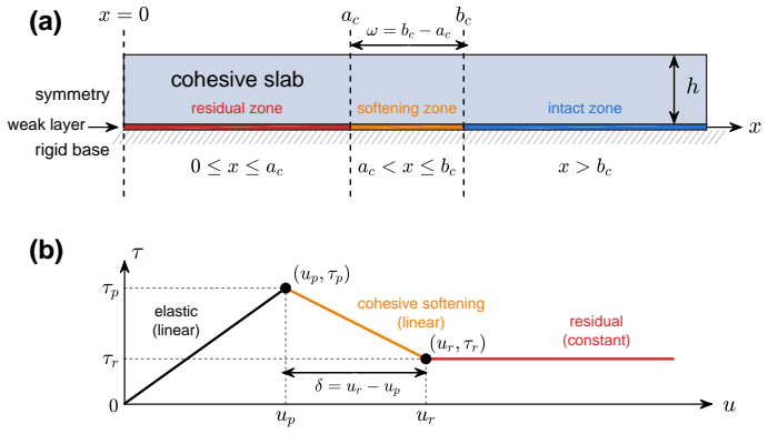
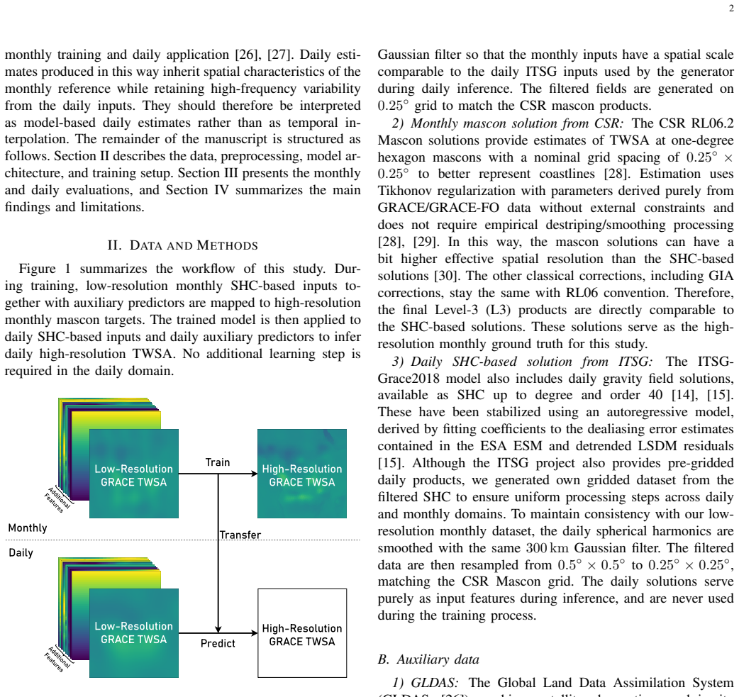
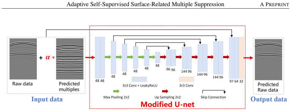
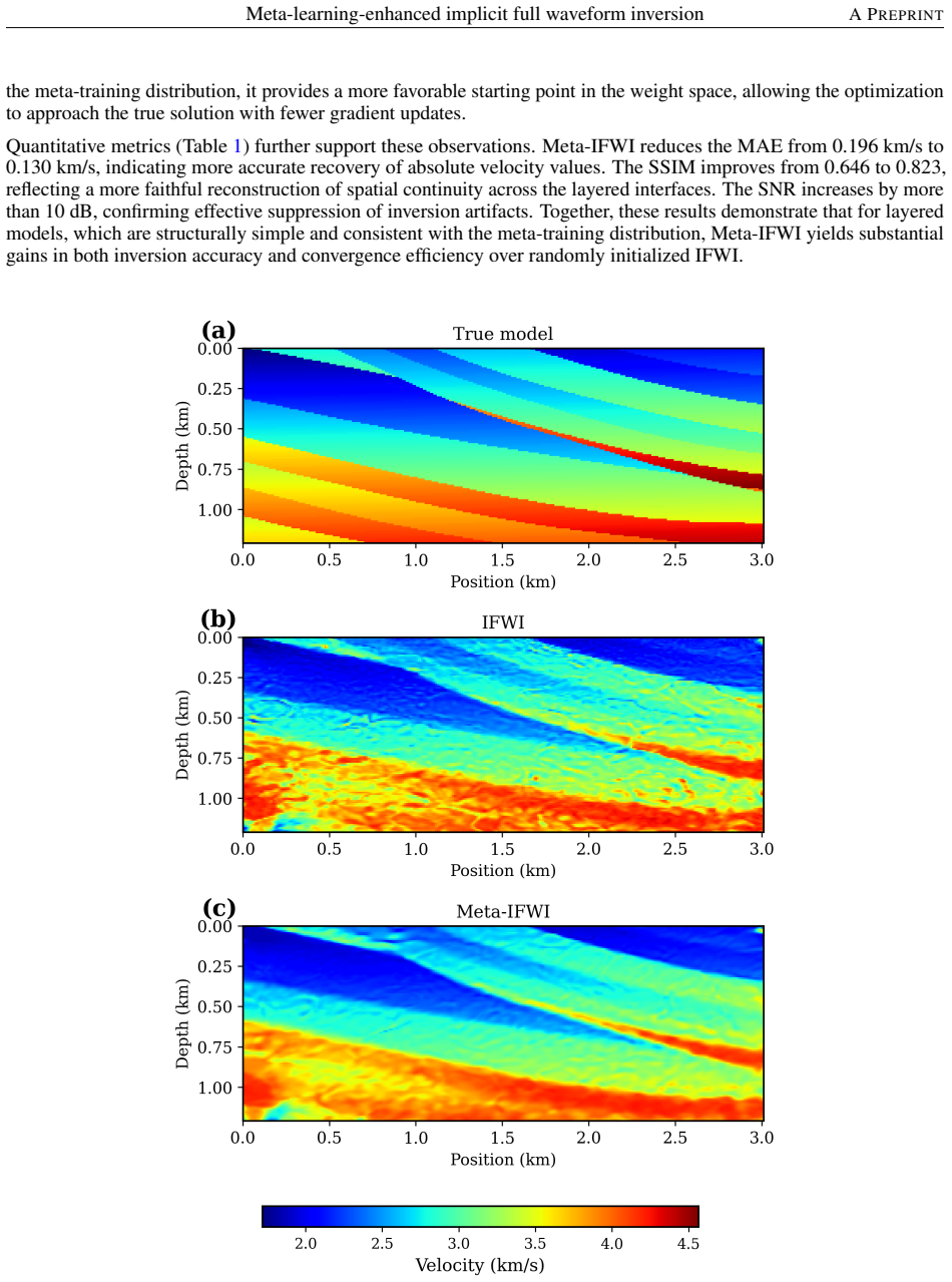
0
Core-mantle bumps drive torques matching observed day-length wobbles
Effects of global core-mantle boundary topography on outer-core convection and topographic torques
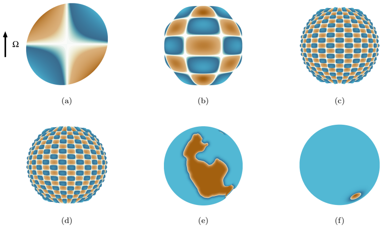
Simulations find deformed flow contours boost convection and produce torques whose size, at Earth conditions, fits decadal rotation changes.
 full image
abstract click to expand
Topography at the core-mantle boundary (CMB) couples the outer core to the mantle and likely generates observable variations in the length of day ($\Delta$LOD) and the geomagnetic field, though these effects remain poorly understood. We use direct numerical simulations of rotating shell convection with finite-amplitude CMB topography to investigate dynamical effects on the outer core. A range of topographic shapes is used, including individual spherical harmonics and a model representing seismically inferred heterogeneities in the deep mantle. As predicted by prior linear theory in the rotating annulus model, a new instability arises for Rayleigh numbers below the onset of convection; we confirm its existence in a global geometry, though the predicted scalings are quantitatively modified. The shape of the geostrophic contours -- lines of constant axial height -- plays a central role: deformed contours allow buoyancy to do work on the time-averaged flow, driving increases in Reynolds and Nusselt numbers of up to $\sim$100\% relative to a spherical boundary. Previous work showed that topographic torques scale linearly with topographic amplitude and quadratically with flow speeds; we confirm this scaling and extend it with new theory that estimates the torques for global, spectrally broad topography. When extrapolated to core conditions, the predicted torques are consistent with the magnitude required to drive observed decadal and subdecadal $\Delta$LOD variations.